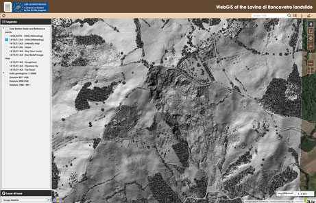
")
")


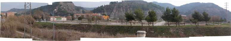
Sallent village (Spain)
Sallent village is located to the center of Catalonia (northeast Spain), at the centre of the Catalan evaporitic basin, 70 km north from Barcelona. In Sallent, the L’Estació neighbourhood is affected by large ground subsidence phenomena that extend within the former exploitation limits of an old underground potash mine (Enrique mine from 1932 to 1973). Mining activities took place at a depth of 260 m. During the exploitation, a great natural cavity of 56 m diameter and 110 m height was found between 150 m and 260 m below the surface, partially refilled by materials falling from the walls and from the top of the cavity. In the 1990s several damages were reported in different buildings. Since then, different monitoring techniques have been implemented. On the one hand, high precision topographic surveys are used to investigate the subsidence phenomena extent on the terrain and its effects on buildings.
On the other hand, in situ extensometers, inclinometers and piezometers are used to investigate the underground conditions and infer the mechanisms that control the subsidence motion in detail. The parameters obtained from the land surface deformation (measured with the automatic total station) and the underground deformation measurements (extensometers network) have been integrated into a real-time monitoring system as a basis for an early warning system developed by the IGC. The use of these techniques, as well threshold values to activate civil protection alarm and communication procedures, are done on the basis of the experience obtained during the investigation of the phenomena.
Surface monitoring networks are based on two different techniques: a high precision topographic levelling and a Geodetic Monitoring System for control building status. The topographic levelling was established in 1997, and originally consisted of 34 points but has grown gradually to near 170 measurements in the L’Estació quarter and surroundings. The measurement frequency was initially monthly, although it has varied to weekly rate during the most active periods (2008 and beginning of 2009). At the critical area, 25 precise prisms are installed on the 8 most vulnerable buildings and monitored by an automatic Leica TCA Total Station in order to control the building response. Furthermore Applied DInSAR techniques based on Ground Based measurements (for 2007-2008 period) and satellite (ENVISAT-ERS images between 1993-2006 period) allow to compare and corroborate velocity average deformation at very local and regional scales respectively.
The underground monitoring network is located around the critical area, right above the natural cavity, and is composed of extensometers, inclinometers and piezometers. These instruments are installed in 15 boreholes at depths that vary between –140 and –15 m, and include 25 rod extensometers, 4 inclinometers (ABS 74, 3 inches, Glötzl Baume β tecnik) and one piezometer. An automatic measurement system was implemented for collecting data from the extensometers and piezometer.
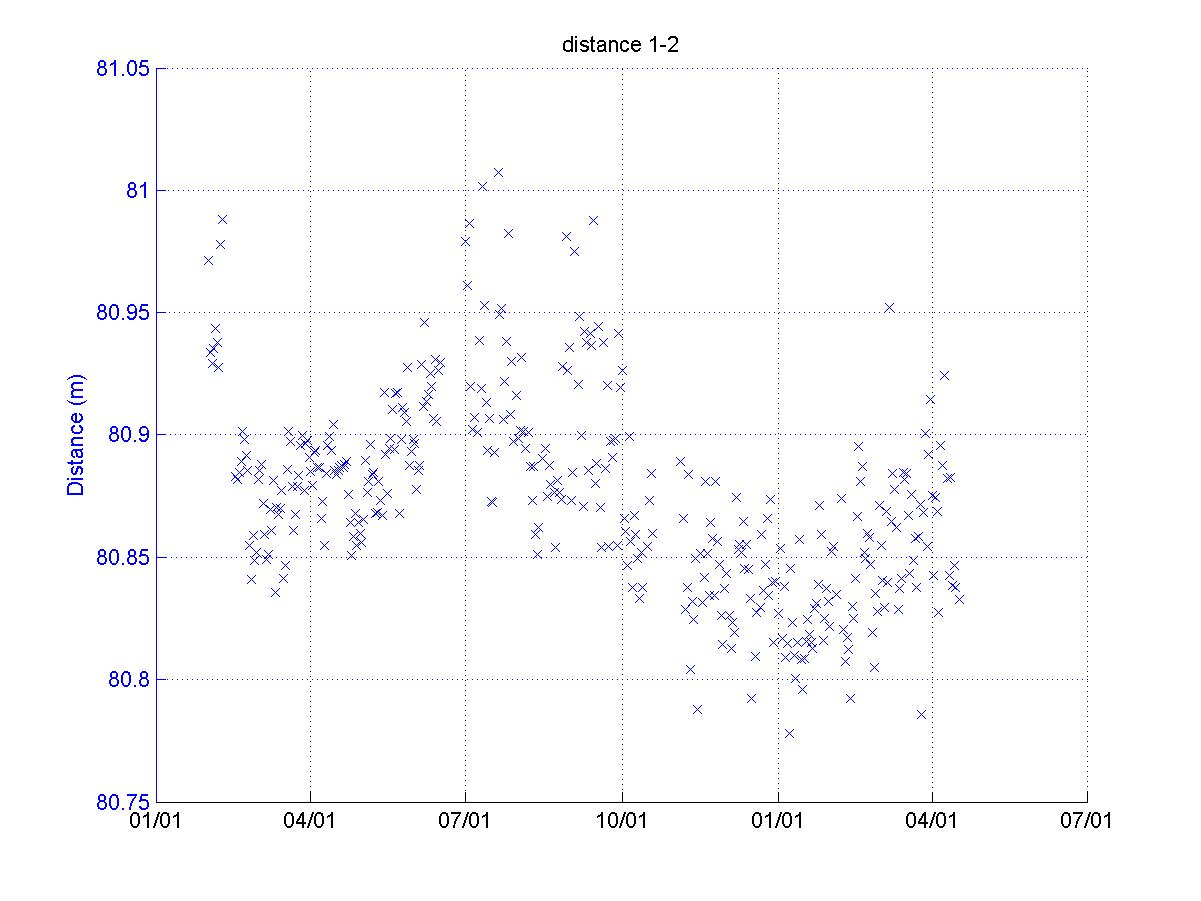
Monitoring has allowed the definition of the extension of the subsidence phenomena, controlled by the extension of the underground mine, with a maintained subsidence velocity of about 1 cm/year. But the more intense surface vertical displacement is monitored by the existing underground cavity and is about 49 cm over the last 13 years, with surface average velocities of about 2.5–4.0 cm/year from the beginning of measurements until July 2008. From this date, the velocity increased to 5.0–8.0 cm/year, and finally in May 2009 there was a significant increase of velocity to between 12–18 cm/year at the surface and 60 cm/year at depth..
An early warning system and an emergency plan for an organized and efficient response by the civil protection authorities has been elaborated and implemented (Procicat Sallent). The alert triggering levels for the plan are defined on the basis of deformation rates in the critical area. The deformation rates are automatically registered by the monitoring instrument networks: data from the automatic measurements in extensometers and building deformation monitoring systems are sent to the reception centre at the Geological Institute (IGC) that processes the information and evaluates the results. In the case of an alert detection, IGC is in charge of immediately informing the civil defense centre for executing the actions established in the emergency plan.
Sallent site is the best monitored mass movement in Catalonia and one of the best in the world for subsidence. It fulfills the requirements for the Wi-GIM system implementation:
a) It is in Catalonia
b) It is active
c) Its associated risk is high (Civil Protection application)
d) The velocity is high enough for the Wi-GIM system in order to appreciate the displacements (total
maximum recorded displacement up to at least one decimetre during the whole monitoring period)
e) The velocity is quite constant (sudden accelerations could damage the SNs and the prisms)
f) It is easily accessible, in order to facilitate frequent instrumentation checks, and to ensure safety
conditions for the operators
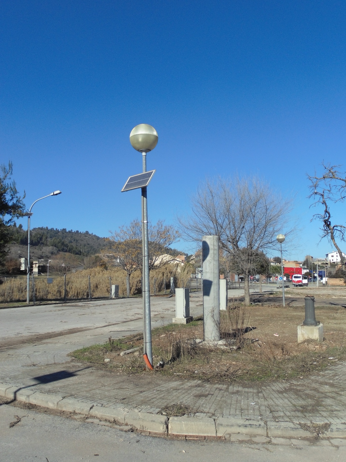
g) It is in an urbanized area and near to communication routes (although this is also the main handicap of the site, where some sensors have been stolen recently; for this reason, Wi-GIM sensors will have to be hidden as much as possible)
h) Its surface is small enough to be fully covered by sensors (max 20-30 ha)
i) It is observable from some panoramic points, which are necessary for the implementation of the traditional monitoring as well as the Wi-GIM systems
j) The investigated area has a good GSM cover for remote monitoring data transmission
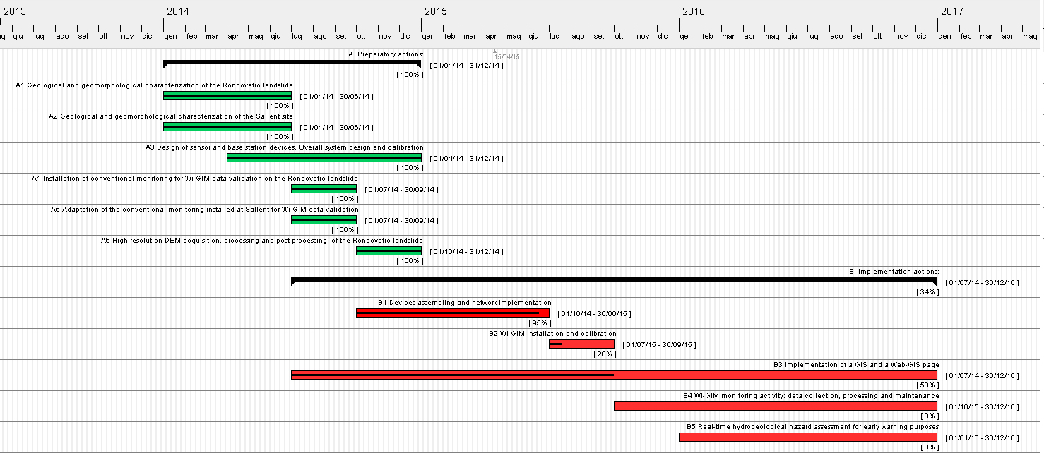
The mass movement magnitude, its kinematic, its main features, its link with the geological setting, and the possible effects of meteorological conditions on displacements is well known. All this knowledge acquired in the IGC has to be processed and analyzed to properly design the overall wireless sensor network and to derive the specifications for both the sensors and the base station devices designing. Action A2 will be completed in 0,5 months.
References
F. LÓPEZ, P. BUXÓ, J. PALAU, J. MARTURIÀ, A. CONCHA, P. MARTÍNEZ. Evaluation of the subsidence and risk of collapse in the Estació neighbourhood of Sallent City, Catalonia (Spain)Land Subsidence, Associated Hazards and the Role of Natural Resources Development. (Proceedings of EISOLS 2010, Querétaro, Mexico, 17–22 October 2010). IAHS Publ. 339, 2010, 170-172
J. MARTURIA, J. RIPOLL, A. CONCHA & M. BARBERÀ. Monitoring techniques for analysing subsidence: a basis for implementing an Early Warning System. Land Subsidence, Associated Hazards and the Role of Natural Resources Development (Proceedings of EISOLS 2010, Querétaro, Mexico, 17–22 October 2010). IAHS Publ. 339, 2010, 264-267.