")
")


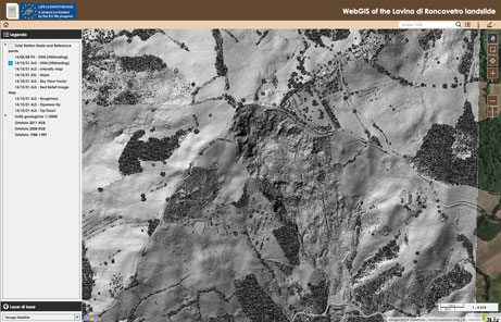
The Lavina Di Roncovetro landslide (RE, Italy)
dott. geol. Giovanni Bertolini
Regione Emilia-Romagna
Servizio Tecnico dei Bacini Affluenti del Po
Download Technical Report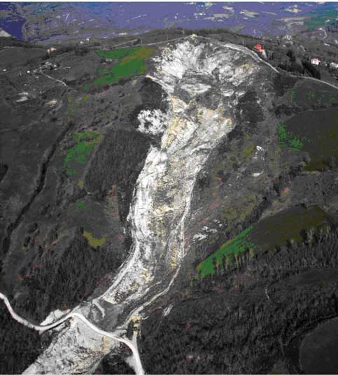 1) History
Almagià, an important precursor of landslide researchers, in publishing the first Italian inventory of landslides, coined the term of “Lavina di Roncovetro”, where Lavina meant (and means also today) Landslide in local idiom. It was the year 1907 and the landslide was already well known. For what we know, the morphological features of this landslide were not so evident in more ancient times, since the oldest existing cartographies, dating in 1821, 1828 and 1858, did not represent it (see figures).
The rapid evolution of this landslide during the last century is also demonstrated by recent documents and images, as shown in the figures. In particular, the rapid retrogression of the crown, now reaching the mountaintop, is evident.
Sallent village (Spain)
Sallent village is located to the center of Catalonia (northeast Spain), at the centre of the Catalan evaporitic basin, 70 km north from Barcelona. In Sallent, the L’Estació neighbourhood is affected by large ground subsidence phenomena that extend within the former exploitation limits of an old underground potash mine (Enrique mine from 1932 to 1973). Mining activities took place at a depth of 260 m. During the exploitation, a great natural cavity of 56 m diameter and 110 m height was found between 150 m and 260 m below the surface, partially refilled by materials falling from the walls and from the top of the cavity. In the 1990s several damages were reported in different buildings. Since then, different monitoring techniques have been implemented. On the one hand, high precision topographic surveys are used to investigate the subsidence phenomena extent on the terrain and its effects on buildings.