")
")

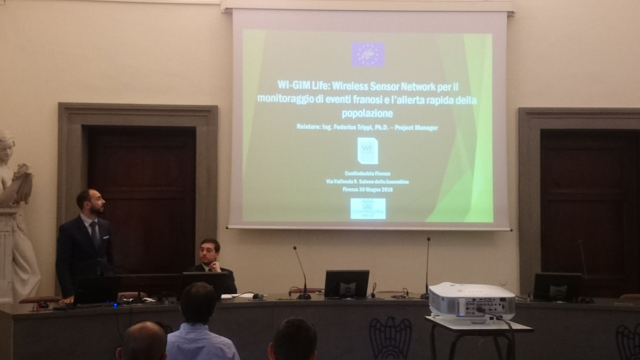
Workshop about LIFE 2016 program had as protagonist Federico Trippi and Rosa Schina
Firenze 30/06/2016
Dissemination to population and potential Industrials stakeholders activity in collaboration with Enterprise Europe Network and Life Networking activities with "Life Re Mida project" - with Donata Cappelli @ Confindustria Firenze.
 |
 |
UNESCO evaluators visit the Sallent Site.
21/06/2016, Sallent (Spain)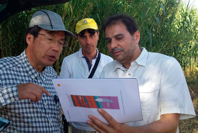 Dr. Setsuya Nakada and Dr Aniello Aloia as UNESCO evaluators of “The Geological and Mining Park of Central Catalonia (UNESCO)” (http://www.geoparc.cat/en/nivells/contingut/titular/qui-is-el-geoparc-2 ) visited Sallent pilot area and in this occasion they was shown to them the Wi-GIM project .
The Geological and Mining Park of Central Catalonia (UNESCO) formed by the Bages region and the municipality of Collbató, is actively working for the protection of its geological heritage, and integrating it in a territorial strategy of sustainable economic development.
The Catalan Potassic Basin is an example of world relevance of the sedimentation of marine evaporitic rocks, with minerals such as halite (common salt) and sylvite (potash). It is formed 37 million years ago in a spectacular tectonic context: the rise of the Pyrenees.
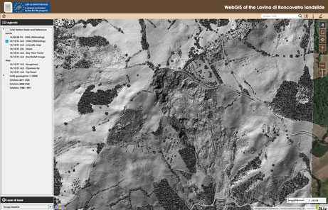
Wi-GIM sensor network system on the Roncovetro
1 Febbraio 2016
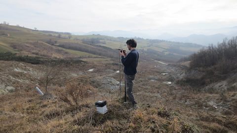
Installing a Wi-GIM sensor network system on the Roncovetro landslide testing site. The cluster is composed of 12 nodes: a master node and 11 slave nodes, two of which equipped with a GPS antenna in addiction to the decawave sensor.
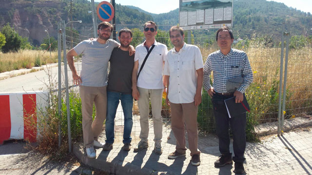
Wi-GIM installation system on Sallent
 The Institut Cartogràfic i Geològic de Catalunya in collaboration with University of Florence and International Consortium for Advanced Design installed two Wi-GIM clusters on the subsiden area of Sallent
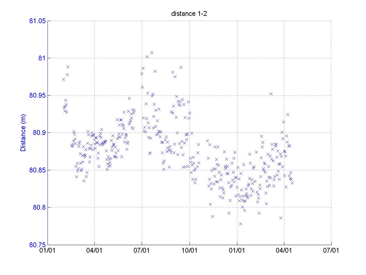
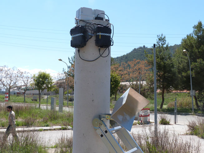
Wi-GIM recording test at DST-UNIFI
A recording test of the new wireless sensor network system has been carried out with a complete cluster consisting of 10 nodes installed at the Department of Earth Sciences at University of Florence: 1 Master Node which coordinates the WSN and performs data aggregation and local storage, equipped with a decawave, a GSM modem, a GPS antenna and a Radar); 3 Slave Nodes equipped with a decawave and a GPS antenna and 6 simple Slave Nodes (without GPS antenna). Each node is powered by its own battery and it is completely self-supporting. The system will make a measure every 10 minutes for a total of 400 distinct measures.
Currently the system can send to the operator a SMS to warn if a battery needs to be charged; at the moment the recorded data has to be downloaded directly from the master node. The developing team is now working on a new firmware which will allow to send via GSM the recorder data every measurement cycle: this will further improve the usability of the system.
|
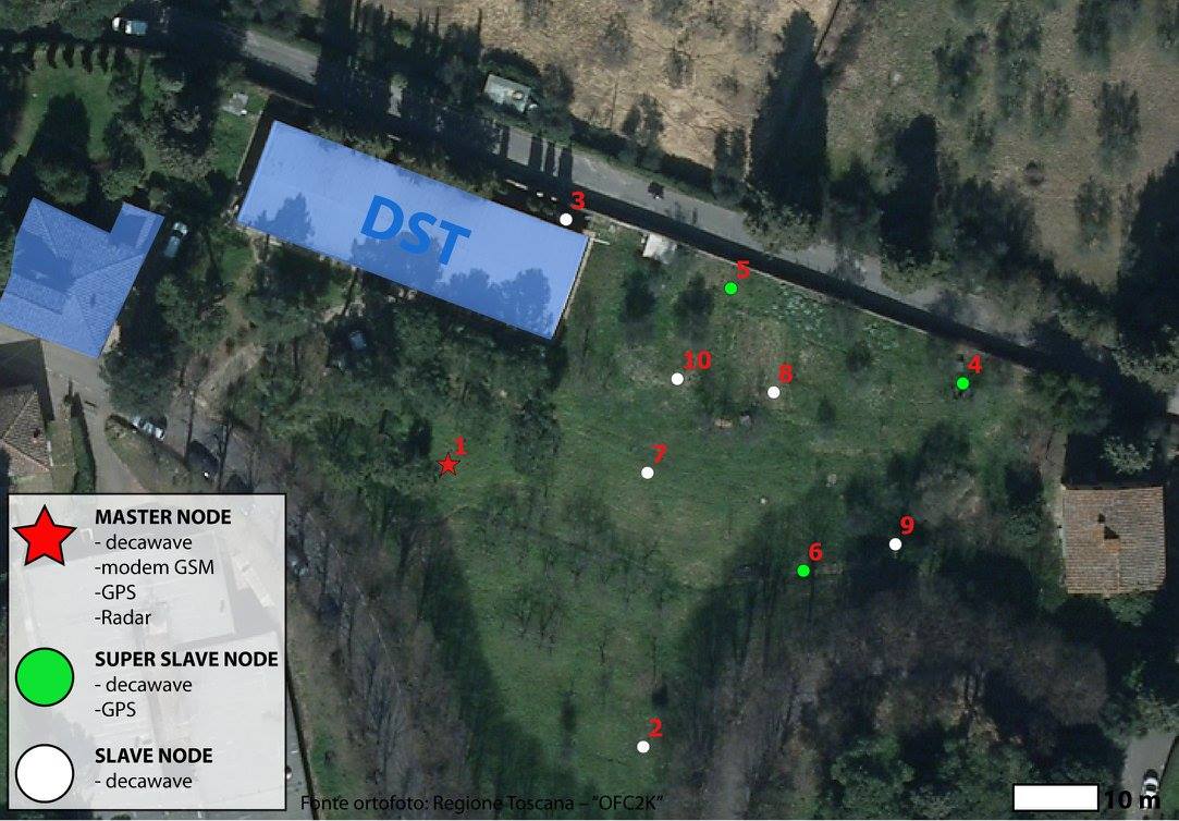
Cluster scheme. The cluster consists of ten nodes: one master node (decawave, GSM modem, GPS and Radar), three "super" slave node (decawave and GPS) and six simple slave node (only decawave). Each node is powered by its own battery and it is completely independent. |
 |